Skip to content

Charlotte County,through time.

6 eras · 1513–2026 · every fact sourced · compiled from the sources shown, not yet reviewed by a historian

Populationfrom 1970

—

Calusa Country and the Spanish Frontier

1513–1865: Calusa Country and the Spanish Frontier

Era 1 · 1513–1865

Calusa Country and the Spanish Frontier

When the Spanish arrived around Charlotte Harbor, the Calusa were the dominant people, and they met Juan Ponce de Leon in 1513 and again in 1521. From then until the end of the Civil War, settlement in what is now Charlotte County was limited to Cuban ranchos, small military or trading posts and cattle docks.

Image shown for this era: U.S. Coast Survey nautical chart of 1863 showing Boca Grande Pass, the main entrance to Charlotte Harbor, with soundings, the barrier islands and an inset sketch of the whole harbour.. 1863 · U.S. Coast Survey; Library of Congress, Geography and Map Division (via Wikimedia Commons) · Public domain · Source

Key moments

  1. Calusa meet Ponce de Leon near Charlotte Harbor

    The Calusa, the dominant people around Charlotte Harbor, encountered Juan Ponce de Leon in 1513 on his first exploration of the Florida peninsula, and again in 1521 when he tried and failed to found a Spanish colony in the region.

    Source

    1. Charlotte County Owner's Manual (History section), Charlotte County Government (accessed 2026-11-09)
Sources

  1. Charlotte County Owner's Manual (History section), Charlotte County Government (accessed 2026-11-09)
  2. Charlotte County Owner's Manual (History section), Charlotte County Government (accessed 2026-11-09)
Correct this era: Calusa Country and the Spanish Frontier

Era 2 · 1866–1920

Settlers, Rails, Fish and Phosphate

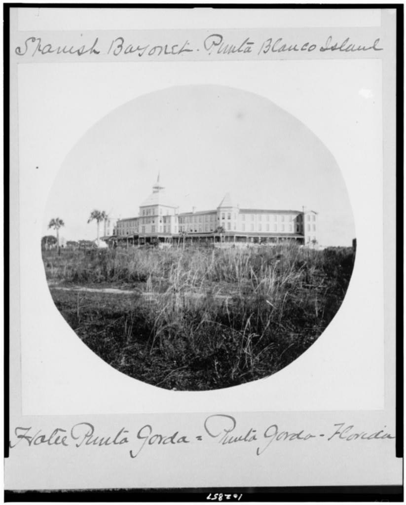
After 1865, settlements such as Charlotte Harbor, Hickory Bluff, Punta Gorda and Cleveland grew with the railroad and with turpentine, timber, fishing and phosphate. The Florida Southern Railroad reached Punta Gorda, phosphate was discovered along the Peace River, and Charlotte Harbor became known for sport fishing.

Image shown for this era: Round-framed black-and-white photograph of the large multi-story Hotel Punta Gorda with a central tower, seen across a field of tall grass with palm trees at left; handwritten captions above and below.. 1890 · Library of Congress, Prints and Photographs Division · Public domain · Source

Key moments

  1. Florida Southern Railroad reaches Punta Gorda

    Isaac Trabue persuaded the Florida Southern Railroad to extend service south to his settlement. The railroad's arrival in 1886 boosted the town and its commercial and recreational fishing.

  2. Punta Gorda's Long Dock: the end of the line

    The Florida Southern Railway's narrow-gauge tracks ran out onto a 4,000-foot "Long Dock" at Punta Gorda, the southernmost railroad trackage in the U.S., connecting with steamers to New Orleans, Key West and Havana. The railroad was extended south in 1904.

    Source

    1. Southernmost Railroad Terminal (Florida Historical Marker), Florida Division of Historical Resources (accessed 2026-11-09)
  3. Englewood is founded on Lemon Bay

    Three brothers started a 24-block community and named it Englewood after their Illinois hometown. Englewood is known as the "two county town" because it lies in both Sarasota and Charlotte counties.

    Source

    1. Tour of Historic Englewood, Florida, Florida Historical Society (accessed 2026-11-09)
1 more from this era
  1. Phosphate railroad to Boca Grande completed

    The Charlotte Harbor and Northern Railway, built by the American Agricultural Chemical Company to carry Peace River phosphate to Port Boca Grande, was completed. Its trestles crossed Gasparilla Sound from Placida.

    Source

    1. Gasparilla Train Trestle Report, Charlotte County Government (accessed 2026-11-09)
Correct this era: Settlers, Rails, Fish and Phosphate

Era 3 · 1921–1954

A New County and the Florida Boom

Charlotte County was split from DeSoto County in 1921 with Punta Gorda as its seat, and the same year a bridge over Charlotte Harbor opened. Land speculation peaked in 1926, and a new county courthouse opened in 1928.

Image shown for this era: Vertical black-and-white aerial photograph labeled "Punta Gorda Bridge, Florida": the town's street grid on the left shore, a long bridge crossing the dark water of the river to the opposite shore at right.. 1944 · U.S. War Department, Army Air Forces / National Archives and Records Administration (NAID 23936777), via Wikimedia Commons · Public domain · Source

Key moments

  1. Charlotte County is created, with Punta Gorda as county seat

    After decades of debate over dividing DeSoto County, the 1921 Legislature created Charlotte County. It officially came into being on April 23, 1921, with Punta Gorda designated the county seat.

    Source

    1. Charlotte County Owner's Manual (History section), Charlotte County Government (accessed 2026-11-09)
  2. First bridge over Charlotte Harbor opens

    Begun in 1916 with bonds issued by the town of Charlotte Harbor and Punta Gorda, the first bridge over Charlotte Harbor opened a few months after Charlotte County was created.

    Source

    1. Charlotte County Owner's Manual (History section), Charlotte County Government (accessed 2026-11-09)
  3. Land boom peaks in Punta Gorda

    Land sales and building in Punta Gorda rose through the early 1920s, and by 1926 the Florida land boom had reached its peak; the Punta Gorda Herald described the city's "era of startling growth."

1 more from this era
  1. Charlotte County Courthouse opens

    In 1927 the county bought land at Taylor Street and Olympia Avenue from George Brown for $25,000; the new Charlotte County Courthouse opened there with great fanfare the following March.

    Source

    1. Charlotte County Owner's Manual (History section), Charlotte County Government (accessed 2026-11-09)
Correct this era: A New County and the Florida Boom

Era 4 · 1955–2003

Port Charlotte and Postwar Growth

The Mackle brothers' General Development Corporation began selling installment lots at Port Charlotte in late 1955, a development that grew to more than 90,000 acres with North Port Charlotte. The Boca Grande phosphate port peaked in the 1960s and early 1970s, and county government moved into a new administration building in Murdock in 1981.

Image shown for this era: USGS 1981 topographic-bathymetric map of Charlotte Harbor; at top right the built-up street grids of Port Charlotte and Punta Gorda face each other across the Peace River, with Englewood, Boca Grande and Cape Coral along the coast.. 1981 · U.S. Geological Survey and National Ocean Survey (via Wikimedia Commons) · Public domain · Source

Key moments

  1. Port Charlotte lot sales begin

    The Mackle brothers' venture began writing installment contracts for home sites at Port Charlotte in late 1955, turning a slow local housing project into a mass-marketed retirement community.

    Source

    1. General Development, The Mackle Company (accessed 2026-11-09)
  2. Last passenger train to Boca Grande

    A road causeway to Gasparilla Island was completed in 1958, and rail passenger service to Boca Grande ended the next spring.

    Source

    1. Gasparilla Train Trestle Report, Charlotte County Government (accessed 2026-11-09)
  3. Boca Grande phosphate port closes

    Work trains kept running over the Placida trestles to the south end of Gasparilla Island until the phosphate port closed in 1979. Charlotte County later took ownership of the trestles and built fishing piers on them.

    Source

    1. Gasparilla Train Trestle Report, Charlotte County Government (accessed 2026-11-09)
1 more from this era
  1. Charlotte County adopts home rule charter

    A home rule charter gave the Board of County Commissioners the authority to pass laws.

    Source

    1. Charlotte County Owner's Manual (History section), Charlotte County Government (accessed 2026-11-09)

Sources

  1. General Development, The Mackle Company (accessed 2026-11-09)
  2. The Breakup, The Mackle Company (accessed 2026-11-09)
  3. Gasparilla Train Trestle Report, Charlotte County Government (accessed 2026-11-09)
  4. Charlotte County Owner's Manual (History section), Charlotte County Government (accessed 2026-11-09)
Correct this era: Port Charlotte and Postwar Growth

Era 5 · 2004–2017

Hurricane Charley and the Babcock Ranch Deal

Hurricane Charley caused catastrophic wind damage in Charlotte County in August 2004. In 2006 the State of Florida bought most of the former Crescent B (Babcock) Ranch as a preserve, with a portion kept for the Babcock Ranch community.

Image shown for this era: Aerial color photograph of a Punta Gorda neighborhood after Hurricane Charley: rows of homes with roofs stripped or torn open, debris across yards and streets, and broken trees near a waterway.. 2004 · Andrea Booher / FEMA, via Wikimedia Commons · Public domain · Source

Key moments

  1. Hurricane Charley devastates Charlotte County

    Charley struck Florida's southwest coast as a Category 4 hurricane in August 2004 and caused catastrophic wind damage in Charlotte County, with homes condemned across the county.

    Source

    1. Hurricane Charley Strikes Florida (fact sheet), National Weather Service, Tampa Bay Area (accessed 2026-11-09)
  2. State buys Babcock Ranch Preserve

    The State of Florida bought most of the 91,361-acre Crescent B Ranch in southeast Charlotte County as the Babcock Ranch Preserve, one of the largest conservation purchases in state history; a portion was kept for the Babcock Ranch community.

    Source

    1. Babcock Ranch Preserve, Florida Fish and Wildlife Conservation Commission (accessed 2026-11-09)

Sources

  1. Hurricane Charley Strikes Florida (fact sheet), National Weather Service, Tampa Bay Area (accessed 2026-11-09)
  2. Babcock Ranch Preserve, Florida Fish and Wildlife Conservation Commission (accessed 2026-11-09)
Correct this era: Hurricane Charley and the Babcock Ranch Deal

Era 6 · 2018–2026

Babcock Ranch and Hurricane Ian

The first residents moved into Babcock Ranch in 2018. In September 2022 Hurricane Ian made landfall near Punta Gorda, and at least 200 homes were destroyed in Charlotte County.

Image shown for this era: A restaurant storefront at Fisherman's Village fenced off with green-screened chain-link fencing and an "Access Temporarily Closed" sign, a directory sign in the foreground and a balcony with string lights above.. 2022 · PCHS-NJROTC, CC BY-SA 4.0, via Wikimedia Commons · CC BY-SA · Source

Key moments

  1. First residents move into Babcock Ranch

    More than a decade after the ranch deal, the first residents moved into Babcock Ranch's Lake Timber neighborhood; the community held its hometown grand opening on March 10, 2018.

    Source

    1. Timeline of Community Development, Babcock Ranch (Kitson & Partners) (accessed 2026-11-09)
  2. Hurricane Ian makes landfall near Punta Gorda

    After landfall on Cayo Costa, Hurricane Ian's large eye made a second landfall near Punta Gorda about an hour and a half later, with an estimated intensity of 125 knots.

    Source

    1. National Hurricane Center Tropical Cyclone Report: Hurricane Ian (AL092022), NOAA National Hurricane Center (accessed 2026-11-09)

Sources

  1. Timeline of Community Development, Babcock Ranch (Kitson & Partners) (accessed 2026-11-09)
  2. National Hurricane Center Tropical Cyclone Report: Hurricane Ian (AL092022), NOAA National Hurricane Center (accessed 2026-11-09)
Correct this era: Babcock Ranch and Hurricane Ian

Then & Now

Charlotte County, 1921 to 2026

Charlotte County is created, with Punta Gorda as county seat · drag to compare

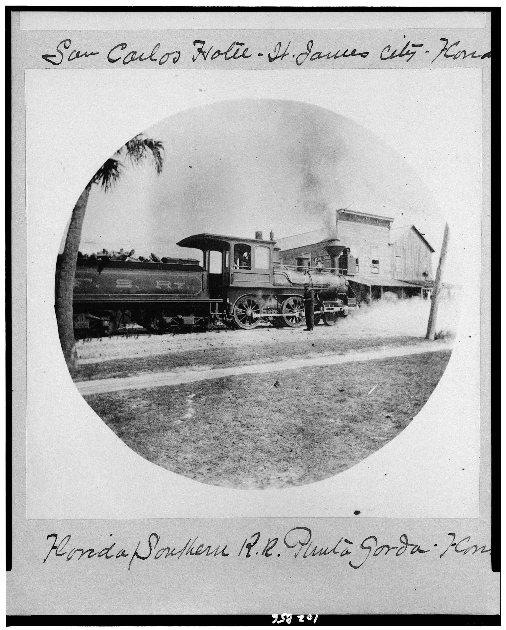
A Florida Southern Railroad steam locomotive lettered 'F.S.R.R.' stands on the tracks in front of a two-storey frame commercial building with a covered porch in early Punta Gorda, shown in a round album print.
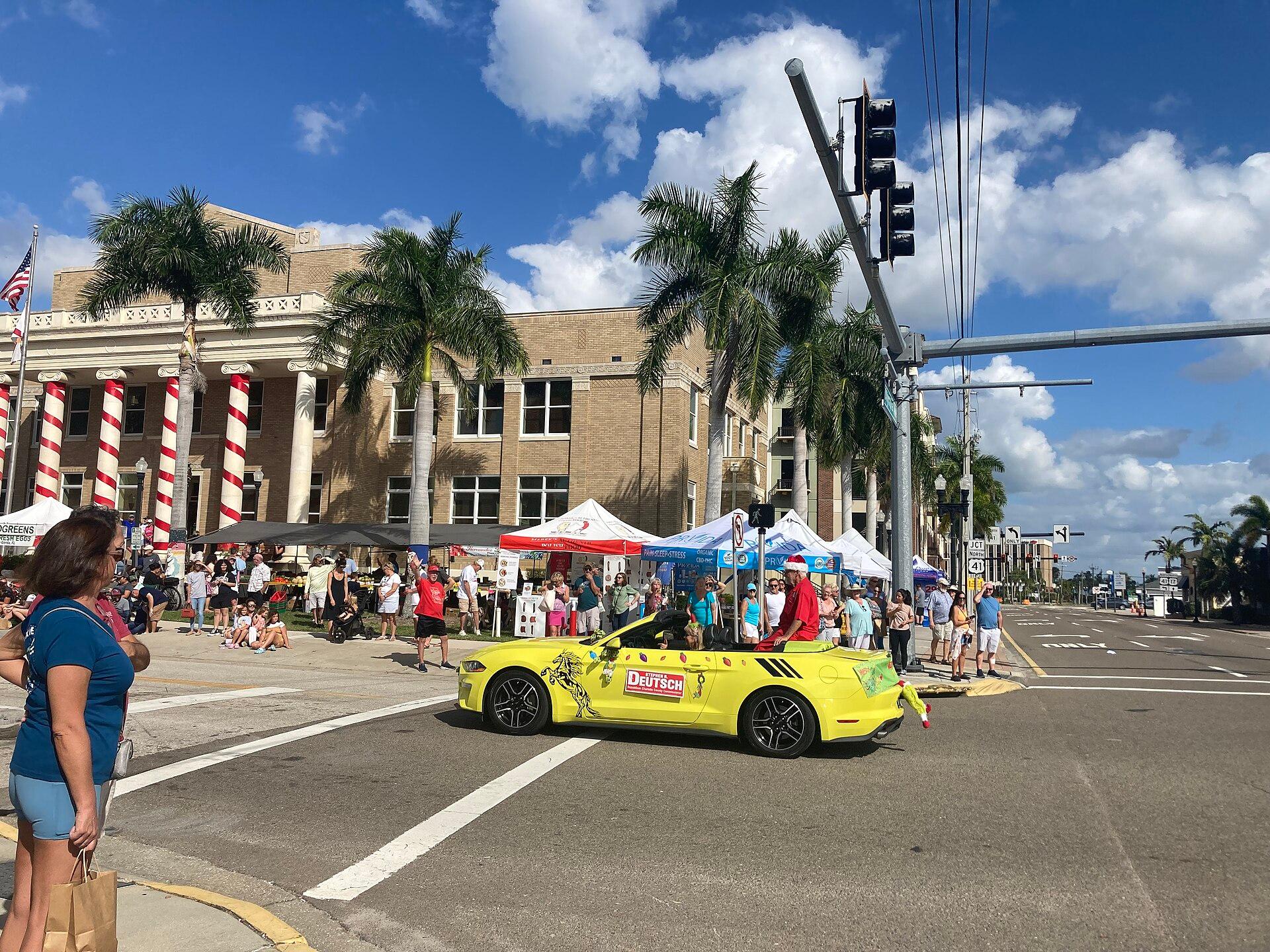
Downtown Punta Gorda on a sunny December day: the columned historic Charlotte County Courthouse, its pillars wrapped like candy canes, stands behind palms and market tents while a convertible rolls by in the Christmas parade and spectators line the street.
19212026

Then image1890 · Joseph John Kirkbride, Library of Congress, Prints and Photographs Division · Public domain · Source

Now image2023 · PCHS-NJROTC, CC BY 4.0, via Wikimedia Commons · CC BY · Source

Help us get it right

History is never finished.

This timeline is compiled from the public records cited on each era and event. Every quote is checked against its source automatically, and items marked Reviewed have also been checked by a person. Images are public domain or openly licensed, each with its credit. If you know something we’ve missed or got wrong, or you hold records of your own, we’d like to hear from you.

See what’s happening in Charlotte County today →