

Era 1 · 1881–1914
Canals and the lone cypress
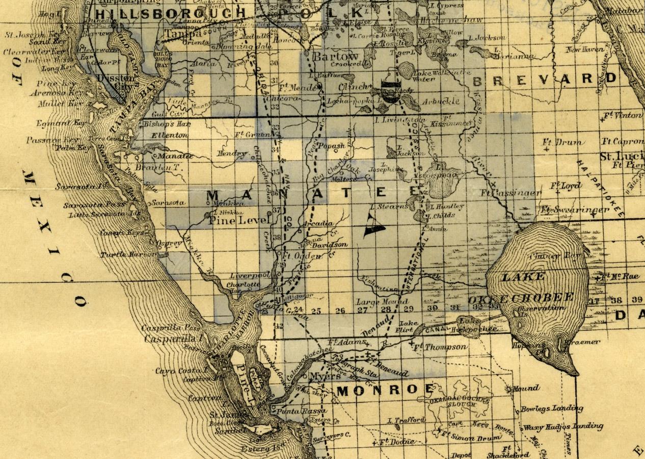
In 1881 Hamilton Disston bought four million acres from the state, and Captain Menge's dredges dug the Three Mile Canal linking Lake Okeechobee to the Caloosahatchee. A flag-topped cypress tree was the only marker for the canal, at the spot that later became Moore Haven, and surveyor John W. Henderson was paid in land along the lake's southwest shore.
Image shown for this era: Detail of an 1883 map of South Florida with Disston company lands shaded blue: Manatee County with Pine Level, Arcadia and Fort Ogden along Peace Creek, Fort Thompson and Fort Denaud on the Caloosahatchee, and a canal running east to Lake Okeechobee.. 1883 · F. (Frederick) Bourquin, 1883; State Archives of Florida, Florida Memory, via Wikimedia Commons · Public domain · Source
Sources
- National Register of Historic Places Registration Form: Moore Haven Downtown Historic District, National Park Service (accessed 2026-11-09)
- National Register of Historic Places Registration Form: Moore Haven Downtown Historic District, National Park Service (accessed 2026-11-09)
